Thursday, February 23, 2023

February 24, 2023 American Flag Trail - Medium and Long groups; Casa Grande Mountain Hike - Short group

Both the medium and long groups hiked the same trail that started at the trailhead for the American Ranch Trail which is a portion of the Arizona Trail. Arizona Trail spans from Mexico to Utah with three-quarters of the trail going through National Forest Park Service lands. Website describing this area and history

We stopped at the Oracle Visitors Centre then the Historic Ranch which is the home of the first Post Office in Arizona. 


Nancy led the long group. The trail was wet with water running down some parts of the path due to the train and snow during the week. The beginning of this trail is in a burnt-out zone, from a fire a few years ago. The fire didn't affect the higher elevations. 


 There is Arizona Trail sign and High Jinks sign about 2.5 miles up the trail. Buffalo Bill Cody once had a mine here. This has been purchased by the country and now is privately owned. The property around it is designated as a National Historical Site. There are old stone structures and a wagon filled with antiques. A mailbox still stands on the property above an old swimming pool. There is a gate to Oak Creek Ranch, that may have been used for a Boy Scout Camp in the past. We could see the ranch once we hiked further up the trail. 


The long group hiked another 1/2 mile to the right of the top of the ridge trail. This took us to a scenic overlook of Oracle. This hike was an out-a-back hide 7.5 miles. 

The medium group was led by Jerry. They hiked 7.2. miles. 

Jerry's photos


Lunch


Short Hike to Casa Grande Mt: (Arcade to Ridge Trail)  Denis will be available at 7:45 a.m. Friday for anyone wanting to do the short hike of approximately 3-4 miles. They leave at 8:00 a.m. and are generally back to Palm Creek by noon. This is a good hike for people who have just started hiking or those who feel they are a bit out of shape. 

Please note that a Palm Creek Hiking Membership and a fee of $10.00 for the year is required for all groups.

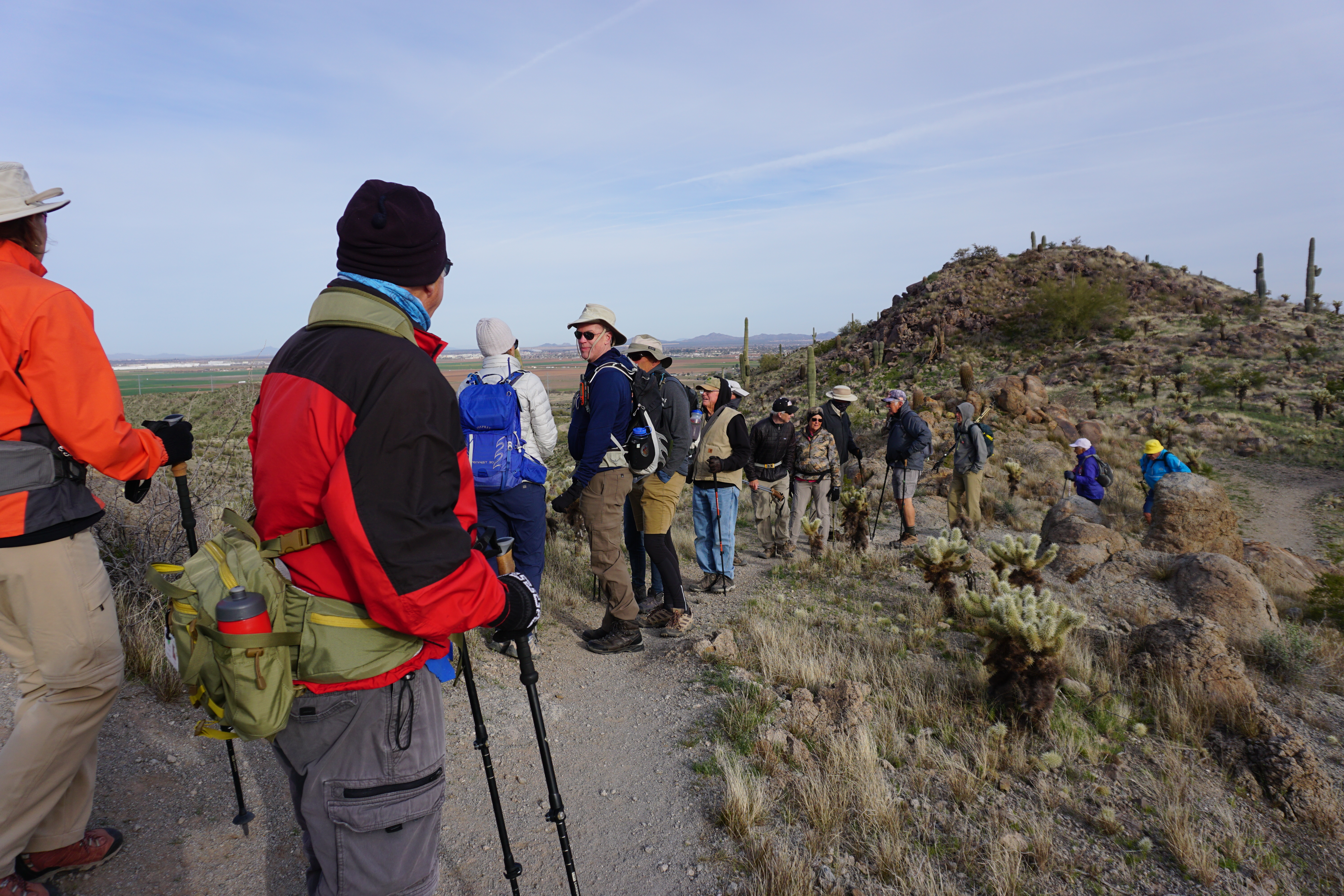
Medium Group Hike:  A scenic in-and-out hike of 7 miles on the Arizona Trail, passage 12, to Oracle Ridge, known as the American Flag Trail. During the hike, we will stop at the HighJinks Mine, once owned by the wild west showman, Buffalo Bill Cody.  Distance 7 miles and rated as easy to barely moderate only because of the elevation climb and distance. No rock scrambling!  At least one hiking pole is recommended and sunscreen would be a bonus. Sunny with a high of 58 degrees.

Long Group Hike: Same hike as the Medium Group with the exception that this group will add an extra mile hiking the ridgeline.

DIRECTIONS: (GPS: American Flag Ranch Trailhead,)

Exit Palm Creek by turning left onto Henness Rd. and continue to Florence Blvd.  Make a left turn onto Florence and continue to I-10 east headed for Tucson for about 24 miles following the caravan as best you can.  At exit 219 turn right and then left onto Picacho Peak Rd. to Camino Adelanta, the frontage road, where you turn right and continue about 10 miles to E Park Link Dr. and turn left. Continue 18 miles to AZ-79 S and turn right. Continue about 10 miles to AZ-77N and turn left. About another 10 miles you turn right onto W American Ave. where you will also see a sign for Oracle. Travel 2.4 miles and turn right onto E Mt. Lemmon Hwy. Continue about 4 miles and turn right onto American Flag Ranch Rd. The parking area is just up the road on the left. There are no restrooms at the trailhead. We will stop at the Oracle Information Center which is a couple blocks past the Circle K. We have made arrangements for it to be open. (Approximately 70 miles and took an hour and twenty minutes)

SUMMARY:

The  American Flag Ranch Trail is part of the Arizona Trail system, Passage # 12. The oldest standing post office building in Arizona is also the trailhead for an exceptional section, 3.5 miles, of the Arizona Trail. There is beauty in all directions amidst the huge granite boulders that characterize Oracle and the Catalina Mountains. There is a gentle incline to the HighJinks Mine where we will stop and survey the surroundings. From there it is a gentle to modest incline to the ridgeline where there are awesome views of the surrounding valley, Picacho Peak and the Biosphere2. Our return is the same route and found it to be very easy to hike.  

INFORMATION:

We meet in the parking lot in front of the Ballroom entrance Fridays 7:30 a.m. to sign up for the hike each hiker is taking and sign up on the carpool sheet. YOU HAVE TWO SHEETS TO SIGN UP ON!  We can always use extra drivers. Riders, please don't forget to reimburse the drivers $10.00 to help with gas. We leave at 8 a.m. sharp and caravan to the hike trailhead following the lead vehicle and always have a sweep vehicle to make sure everyone arrives safely. If for some reason a hike must be canceled, you will receive an email by 6 a.m. and you can go back to bed. For questions, call John Robichaud at 207-446-0650 or Jerry Garrison 307-630-0252

We are getting closer and closer to the overnight (s) hike to Chiricahua National Monument! This is an awesome hike even if you have been there before! Let John R or Nancy know if you are interested!!!! Nancy's phone number is 403-896-9899 and email nanc21.na@gmail.com

If you are on the Palm Creek Hiking Club emails and do not wish to receive our Hiker News, please contact Jerry, email. text or phone!

 Hope everyone can make it Friday! This is not only a great hike but one that is quite historical!


Thursday, February 16, 2023

February 17, 2023 Casa Grande Mountain. Long and Medium Groups: Casa Grande Mountain Ridge Trail - 6-8 miles . Short Group - Arica Lowlands 3-4 miles.

It had been windy all week so we decided to go to Casa Grande Mountain for a hike. 


The long hiking group was led by John. The Long hikers Hiked the an upper Ridge Trail over the Arica Trailhead and on an Inspiration trail there, then back to the Peart Trailhead. 9 Miles.


The medium group led by Nancy, with the help of Armond and Francine, started at the Peart Road Trailhead and hiked the Ridge Trail to the Arica Parking lot and back to the Spine Trail. We took the middle trail where there was a pole to sit on for lunch. There was hardly any wind until we got to the saddle, then there was wind on the other side, but it wasn't too bad. It was great to get out for a hike. 7 mile hike. 


The medium group met up with the Short Hikers who did the Spine Trail loop starting at the Arica Trailhead. Link to Spine Trail Loop.  3.2 miles


Ridge trail to Spine Trail Loop


DIRECTIONS to Medium and Long Groups hike:  (GPS: Peart Road Trailhead) or exit left out of Palm Creek onto Henness Rd and travel to Florence where you make a right. Continue on Florence for approximately 2 miles and turn left on Peart Rd. Continue on Peart for about 3 miles passing under I-8 and after a short left curve continues to the trailhead! Plenty of parking but no restrooms. Lots of foliage!

DIRECTIONS to Short Group hike: (GPS: Arica Trailhead) or exit left out of Palm Creek onto Henness Rd and travel to Florence where you make another left. Continue to I-10 S toward Tucson. Take exit 200, 4.7 miles, toward Sunland Gin Rd/Arizona City. Turn right onto Sunland Gin Rd. and after about 500 feet turn right on W Arica Rd. The trailhead is at the end of this road! No restrooms but plenty of foliage!

SUMMARY:

The Ridge Trail is an easy hike of 7-8 miles, depending on how far the group wants to hike, along the side of the Casa Grande Mountains, from the north end to the south and back. The trail climbs and descends for the whole length of the hike until you reach the southern end of the mountains. There are many awesome views of the valley and the desert vegetation. 

INFORMATION: We meet in the parking lot in front of the Ballroom entrance Fridays at 7:30 a.m. to sign up for the hike each hiker is taking and sign up on the carpool sheet. YOU HAVE TWO SHEETS TO SIGN UP ON!  We can always use extra drivers. Riders, please don't forget to reimburse the drivers $10.00 to help with gas. We leave at 8 a.m. sharp and caravan to the hike trailhead following the lead vehicle and always have a sweep vehicle to make sure everyone arrives safely. If for some reason a hike must be canceled, you will receive an email by 6 a.m. and you can go back to bed. For questions, call John Robichaud at 207-446-0650 or Jerry Garrison 307-630-0252!

Remember, if for some reason a hike must be cancelled, you will receive an email by 6 a.m. and you can go back to bed! For questions, call John Robichaud 207-446-0650 or Jerry Garrison 307-630-0252.

Hope you can make it Friday!