.1.jpg)


.JPG)


 |
| Mary Ann is leaving early, so she received an appreciation card for all she has done for the club this year. She also received her mileage certificate. We are sorry to see her go so soon. |


.jpg)
.jpg)
.jpg)
.jpg)
.jpg)
.jpg)
.jpg)
.jpg)
.jpg)


.jpeg)
Short Hike (C) Easy (GPS: Arica Road Trailhead) Denis will be available at 7:45 a.m. Friday for anyone wanting to do this short hike of approximately 3-4 miles. They leave at 8:00 a.m. and are generally back to Palm Creek by noon. This is a good hike for people who have just started hiking or those who feel they are a bit out of shape.
Please note that a Palm Creek Hiking Membership and a fee of $10.00 for the year are required for all groups.
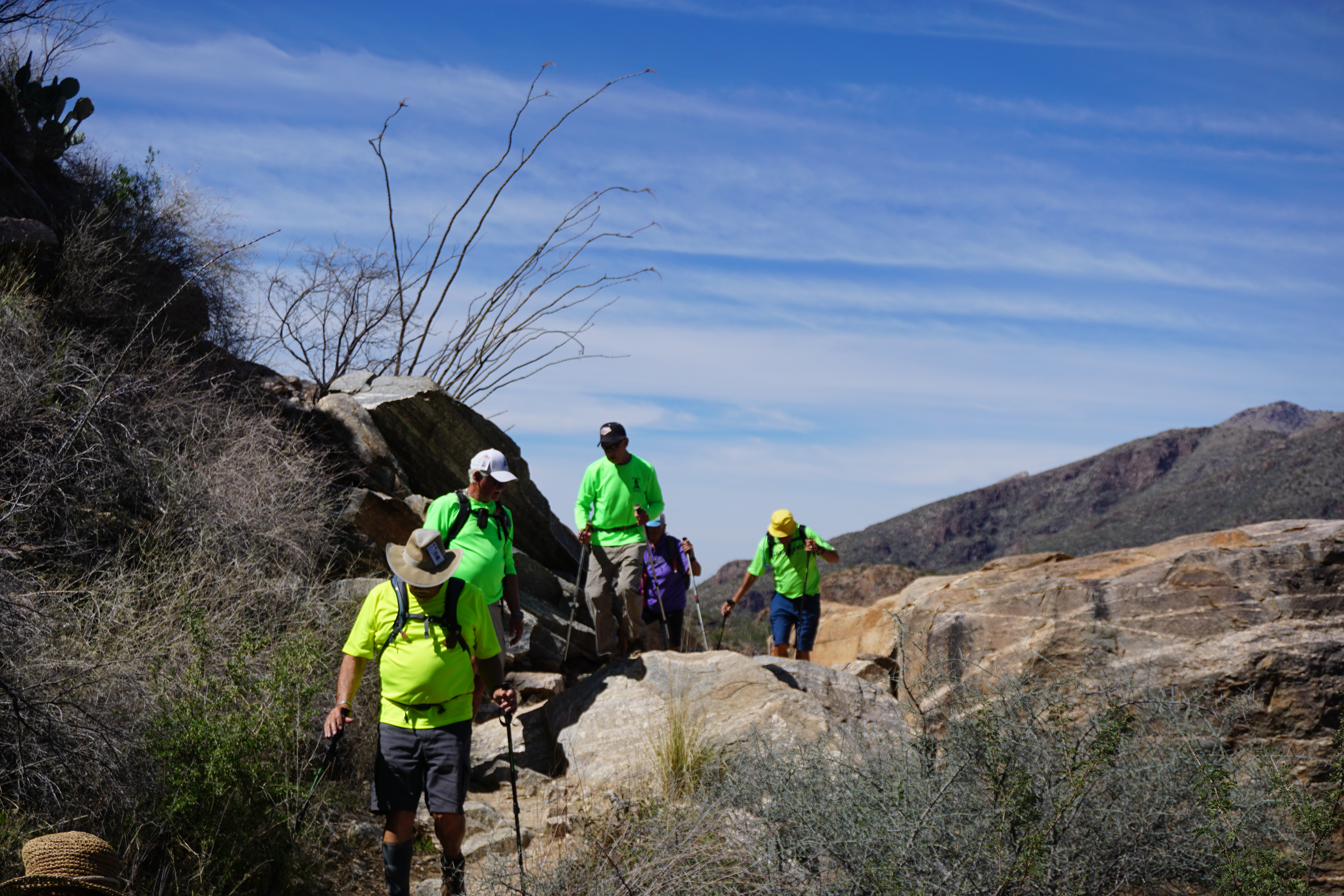
Medium and Long Groups: (B-) In and Out. All groups will hike the same route from the visitor's center approximately 3 miles, eat lunch and hike back down. Depending on the number of hikers we have, we will probably need to break the group into two, a fast and a medium. Parking is $8.00 per vehicle, however free if you have an "America the Beautiful" pass. Extra passes would be appreciated! Again, at least one hiking pole is recommended, along with a couple plastic grocery bags to use crossing what I believe to be just the one creek. Sunscreen would be a bonus! Sunny with a high of 83 degrees. Restrooms at the Sabino Visitor's Center.
DIRECTIONS: (GPS: Sabino Canyon Visitor's Center) It might route you onto Orange Grove and you will get there but I like Ina best! From Palm Creek, we exit left onto Henness Rd. to Florence and make another left to I-10 heading for Tucson. Exit onto I-10 and travel east approximately 54 miles to exit 248, Ina Rd. Make a left onto Ina Rd., which eventually changes to Skyline and Sunrise but stay on this road until Sabino Canyon Rd., about 15 miles. At Sabino Canyon Rd. make a left and a quick right into the parking lot. Distance approximately 69 miles.
SUMMARY:
Sabino Canyon, located within the Coronado National Forest, is one of the premier natural areas in southeastern Arizona. Outstanding scenery abounds, featuring steep rock cliffs and foothills covered with unique desert vegetation adjacent to the riparian corridors.
INFORMATION:
We meet in the parking lot in front of the Ballroom entrance Fridays at 7:30 a.m. to sign up for the hike each hiker is taking and sign up on the carpool sheet. YOU HAVE TWO SHEETS TO SIGN UP ON! We can always use extra drivers. Riders, please don't forget to reimburse the drivers $10.00 to help with gas. We leave at 8 a.m. sharp and caravan to the hike trailhead following the lead vehicle and always have a sweep vehicle to make sure everyone arrives safely. If for some reason a hike must be canceled, you will receive an email by 6 a.m. and you can go back to bed. For questions, call John Robichaud at 207-446-0650 or Jerry Garrison at 307-630-0252.
Next Week's Hikes:
Medium Group: Brown Mountain Loop
Long Group: Cochise's Stronghold, Chiricahua and The Natural Bridge or Sugar Bush
March 24, 2023: Save the date! End of the 2022-2023 season Hiking Club Picnic. More information will follow!


No comments:
Post a Comment
Note: Only a member of this blog may post a comment.