Thursday, February 9, 2023

February 10, 2023 Medium Hike - Fremont Saddle and Lone Pine; Long Hike - Fremont Saddle, Lone Pine and Geronimo's Cave; Short Hike - Casa Grande Mountain.

There were thirty hikers today for the Fremont Saddle and Lone Pine Hike. Twenty-six were on the medium hike and four on the long hike that went to Geronimo's Cave and down Bluff Springs Trail

Nancy and Jerry led the medium groups. All the groups saw Mountain Sheep. 

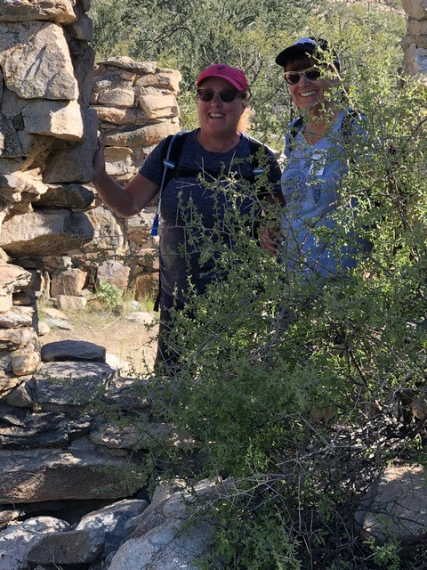
Pictures from Medium Group. 


Mary Anne's pictures of Geronimo's Cave Hike - the Long Hike


John's pictures from the Long Hike


Barb's photos of the Fremont Saddle and Lone Pine Hike - Medium group


Jerry's pictures of the Medium Group 


Denis's picture from Casa Grande Mountain Group


Nellie's photos from Casa Grande Mountain 


Short Hike to Casa Grande Mt: Hike the Arvada Trail to meet the Ridge Trail.  Denis will be available at 7:45 a.m. Friday for anyone wanting to do the short hike of approximately 3-4 miles. They leave at 8:00 a.m. and are generally back to Palm Creek by noon. This is a good hike for people who have just started hiking or those who feel they are a bit out of shape. Please note that a Palm Creek Hiking Membership and a fee of $10.00 for the year are required for all groups.

Medium Group Hike:  A scenic up-and-back hike up the Peralta Trail to Fremont Saddle and the Lone Pine Tree. Distance  6.5 miles and rated as moderate because of the elevation climb and distance. We recommend you bring at least one hiking pole. The forecast is sunny and a high of 70 degrees, so don't forget your sunscreen. 

Long Group Hike: A scenic loop hike of approximately 6.5 miles first up the Peralta Trail to Fremont Saddle, the Lone Pine Tree and then around to Geronimo's Cave and down the Cave Trail. We rate this hike as difficult because of the distance, elevation and rock scrambling! The difficult part is the Cave Trail descent on the steep slip rock section. Again, bring at least one hiking pole, and maybe two. Don't forget your sunscreen. 

DIRECTIONS: (GPS: Peralta Trailhead, Gold Canyon AZ)

Exit Palm Creek by turning right onto Henness and continue to Cottonwood and again make a right turn. On Cottonwood, continue on the back roads following the caravan to Florence Junction, where you turn left onto the 60W ramp heading toward Phoenix. Travel on Hwy 60 approximately 8 miles to the first traffic light, which is E Peralta Rd, and make a right turn. Keep on E Peralta Rd for about 5 miles and then turn left on Peralta Rd for another 2 miles to the trailhead. 

SUMMARY:

This is a very good hike up the Peralta Canyon to Fremont Saddle and the Lone Pine Tree. There are spectacular views of the valley area and breathtaking views of Weaver's Needle to the north of the saddle. The gradual ascent, 1366 feet, will get your heart pumping, but also offers views of interesting rock formations, including hundreds of hoodoos and steep walls of the canyon. From the saddle, we will hike to the Lone Pine Tree, which has an interesting story we will explain at the site. This is where both groups will have lunch! The medium group will return the same route they came and the long group will return via the Cave Trail to view Geronimo's Cave and along the ridgeline, which offers further spectacular views of the trail we took on the way up to the saddle. The long hike will continue to the Bluff Springs Trail and back to the Peralta Trailhead. 

INFORMATION: 

We meet in the parking lot in front of the Ballroom entrance Fridays 7:30 a.m. to sign up for the hike each hiker is taking and sign up on the carpool sheet. YOU HAVE TWO SHEETS TO SIGN UP ON!  We can always use extra drivers. Riders, please don't forget to reimburse the drivers $10.00 to help with gas. We caravan to the hike trailhead following the lead vehicle and always have a sweep vehicle to make sure everyone arrives safely. If for some reason a hike must be canceled, you will receive an email by 6 a.m. and you can go back to bed. For questions, call John Robichaud at 207-446-0650 or Jerry Garrison 307-630-0252

Our hike next week, Friday, February 17th -  American Flag Ranch Trail outside of Oracle Az. More information will follow!

Nellie is finishing the shirt orders and will be at this Friday's hike to collect money, however, you can also contact her at site # 1640 or px 780-940-5922. We have to pay for the shirts when we turn in the order!

February is here and the overnight hike to the Chiracahua National Monument is planned for March 17, 18, and 19th. More information will follow. You can let John R. know if you are interested. Nancy will have a sign-up sheet at the parking lot on Friday. 

If you are on the Palm Creek Hiking Club emails and do not wish to receive our Hiker News, please contact Jerry by email, text or phone.


Sunday, February 5, 2023

February 3, 2023 - Medium and Long Groups - Dove Mountain, Short Group - Casa Grande Mountain - Hanna Road Trailhead - to the Flag and Back


Nancy led the long hike, starting at the Hotel Spur Trail, then going onto Upper Javelina to the Upper Javelina Spur Trail and onto Wild Mustang. The trail is steep at first, and we had views of the Ritz Carlton Hotel and Golf Course below. We came to a viewpoint where the mountains in the distance were identified. From there we continued to hike up and down washes continuing to gain elevation at 3.5 miles and about 1300 feet elevation gain. The trail leveled out as we hiked Wild Mustang. This trail meets up with Wild Burro Trail. We followed Wild Burro to the Alamo Springs where we had lunch. 
After lunch, we took the Alamo Springs Trail with about 150 feet elevation gain until we came to the Alamo Spur Trail which took us down to meet up with the Wild Burro Trail again. We turned onto a trail that took us to the Stone House and a trough that was used by ranchers. After a few minutes of picture taking we hiked back to the trailhead on Wild Burro Trail. Total hike was 9 miles. 


We met up with the medium group at Lunch time. They headed out soon after we arrived. 


Just after lunch, starting Alamo Springs Trail. (Pictures taken toward the Springs where we ate lunch)


This is a mutation or growth of a Buckhorn or Staghorn Cholla Cactus

Desert Marigold


Small Petroglyph on the Wild Burro Trail 

Trailhead station. Has Maps, a notice board and a place to sign in. 

Wild BurroTrailhead


All Trails Map Link

John led the medium group started at Wild Burro Trailhead off the parking area. They hike up Wild Burro Trail on level ground to the Alamo Springs Spur Trail (which is a steep climb to Alamo Springs Trail). This trail goes winds downhill to a beautiful rocky wash with an old stone well called Alamo Springs. A good place for lunch. The two groups met here for a short time and then the medium hikers continued on their hike down the steep Wild Burro Trail. This trail leads to a stone house and trough used by ranchers in the past. Then they followed Wild Burro Trail back to the trailhead. About 7-mile hike.

Alamo Springs Spur Trail


The medium group at the Stone House 


John and Jerry saw a Javelina on the pre-hike at Dove Mountain on Wednesday.

Casa Grande Mountain
Denis led Casa Grande Mountain Hike. This group went up the Bolt Trail to American Flag and back down the road to the Hanna Trailhead. 


Summary of the Hikes for the Newsletter

Short Hike to Casa Grande Mt: Hike to the towers off Hanna Rd. and to the Flag and back.  Denis will be available at 7:45 a.m. Friday for anyone wanting to do the short hike of approximately 3-4 miles. They leave at 8:00 a.m. and are generally back in Palm Creek by noon. This is a good hike for people who have just started hiking or those who feel they are a bit out of shape. Please note that a Palm Creek Hiking Membership and a fee of $10.00 for the year are required for all groups.

Medium Group Hike:  A scenic loop hike at Dove Mountain hiking the Wild Burro Trail to Alamo Springs Trail via the Alamo Springs Spur Trail and back to the Wild Burro with lunch at Alamo Springs. Continue the Wild Burro to the stone house and cistern and petroglyph. Distance  6.5 miles and rated as( moderate) because of the elevation climb and distance.  At least one hiking pole is recommended and sunscreen would be a bonus. Temperature is forecast to be partly cloudy and a high of 74 degrees.

Long Group Hike: A scenic loop hike of approximately 8.5 miles hiking the Hotel Spur Trail, Upper Javelina Trail, Wild Mustang Trail, Alamo Springs Trail and Spur Trail to the Wild Burro Trail. Lunch will be at Alamo Springs! Rated ( Moderate +) because of the distance and elevation! Again, at least one hiking pole is recommended and sunscreen would be a bonus.

DIRECTIONS: (GPS: Wild Burro Trailhead, 14810 N. Secret Springs Dr.,)

Exit Palm Creek by turning left onto Henness Rd. and continue to Florence Blvd.  Make a left turn onto Florence and continue to I-10 east headed for Tucson. Continue on I-10, following the caravan as best you can, until exit 240, Tangerine Rd. Exit the interstate and turn left onto West Tangerine and continue approximately 5 miles to N Dove Mountain Blvd. where you again turn left. Continue on Dove Mountain Blvd. for about 4.5 or until you come to the traffic circle. Enter the circle and take the first exit onto N Secret Springs Dr. As you enter Dove Mountain Resort there is a guardhouse where we stop and explain that we are there to hike! No fee! The trailhead is a short distance up the road on the right. Plenty of parking and good restrooms! (57 miles)

SUMMARY:

The secluded Tortolita Mountains and its many trails offer adventurous hikers exclusive access to some of the most picturesque landscapes in Southern Arizona. There is an array of Palo Verdes, mesquites, ironwoods and cacti. You will also see the evidence of the Hohokam that camped at Alamo Springs and their petroglyphs that date back to the 1100-1400 centuries. Take a walk through the stone house that an early rancher built and be sure to be on the lookout for Javelinas. John and I saw three of them this morning on the pre-hike!

INFORMATION:

We meet in the parking lot in front of the Ballroom entrance Fridays at 7:30 a.m. to sign up for the hike each hiker is taking and sign up on the carpool sheet. YOU HAVE TWO SHEETS TO SIGN UP ON!  We can always use extra drivers. Riders, please remember to reimburse the drivers $10.00 to help with gas. We caravan to the hike trailhead following the lead vehicle and always have a sweep vehicle to make sure everyone arrives safely. If for some reason a hike must be canceled, you will receive an email by 6 a.m. and you can go back to bed. For questions, call John Robichaud at 207-446-0650 or Jerry Garrison at 307-630-0252

Nellie is still doing shirt orders but she will not be at this Friday's hike, however, Nancy will be there to share information, prices, sizes, colors, etc. and take shirt orders and collect money! At this point we are short by 11 shirts and Nellie would like to wrap this up by February 5th!  You can also contact her at site # 1640 or phone 780-940-5922.

 February is here and the possibility of an overnight hike to Chiracahua is just next month! More information will follow but you need to let John R. know if you are interested!

If you are on the Palm Creek Hiking Club emails and do not wish to receive our Hiker News, please contact Jerry, by email. text or phone!


abc